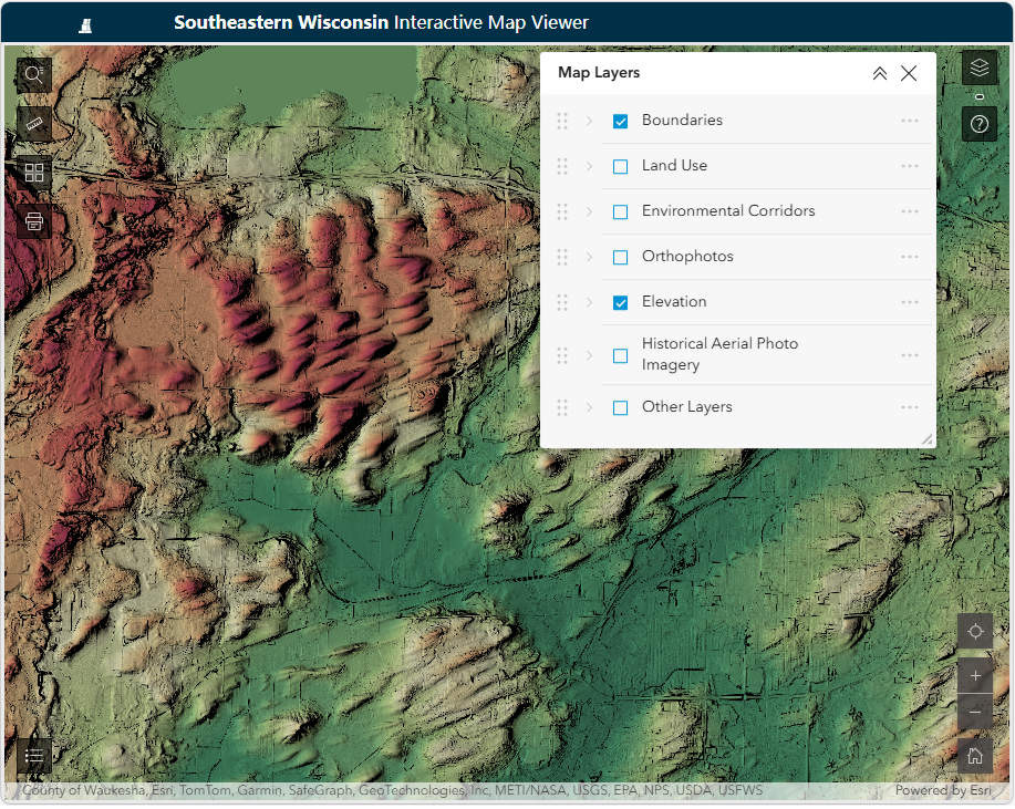
These data are available through the Commission’s Interactive Mapping Application, which currently includes the following maps:
- Land Use
- Environmental Corridors
- Wetlands
- Soils
- Orthophotography
- Municipal Boundaries
- Surface Elevation Data (NEW)
The Commission’s Interactive Mapping Application provides data essential to the planning process and a separate app provides access to U.S. Public Land Survey System information.
Regional mapping activities in Southeastern Wisconsin have involved planning agencies at both the regional and local levels. The Commission has collected and prepared resource and planning-related mapping since 1963. Over the years, the Commission has acquired and developed a regional geographic information system of digital mapping that includes land use, environmental corridors, and other spatial data essential to the planning process.
In spring 2026, the Commission updated its Web Mapping Application. The updated version includes all map layers from the original, along with additional tools and layers, and a more modern, efficient interface. Highlights include:
These data are available through the Commission’s Interactive Mapping Application, which currently includes the following maps:
At the local level, every county and many city, village, and town governments in Southeastern Wisconsin have developed digital mapping capabilities as part of their planning activities. These counties and communities maintain a variety of maps, including topographic, real property boundary line (parcel), and planning-related mapping, for use in their administrative and planning functions.
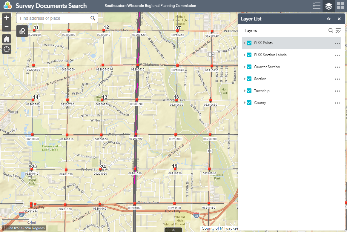
Related to our County Surveying services for 6 Counties in the Region, land survey and control survey documents are available for the entire Region through the Commission’s Public Land Survey System (PLSS) Document Search Application. Through this application, users can search for and view records of U.S. Public Land Survey System control stations (dossier sheets) and Control Survey Summary Diagrams (CSSDs).