Regional mapping activities in the Southeastern Wisconsin Region have involved planning agencies at both the regional and local level. The Southeastern Wisconsin Regional Planning Commission, as the official planning agency for the seven-county area, has collected and prepared resource and planning-related mapping since 1963. Over the years, the Commission has acquired and developed a regional geographic information system of digital mapping that includes land use, soils, environmental corridors, and other spatial data essential to the planning process.
At the local level, every county and many city, village, and town governments in the Southeastern Wisconsin Region have developed digital mapping capabilities as part of their planning activities. These municipalities maintain a variety of maps, including topographic, real property boundary line (parcel), and planning-related mapping, for use in their administrative and planning functions.
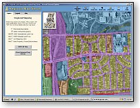
The Regional Map Server is a mapping application that provides access to planning and resource maps of the Southeastern Wisconsin Region. A cooperative effort between the seven counties of the region and the Southeastern Wisconsin Regional Planning Commission, the map server offers access to region-wide planning maps and orthophotography, as well as maps contributed by a number of counties.
|
Currently, the maps available on the Regional Map Server include:
|
Metadata, providing detailed information about the origin, lineage, and content of the data sets, is also available for the map layers displayed in the Regional Map Server.
A number of municipalities in the Southeastern Wisconsin Region maintain websites that provide access to maps, aerial photography, and property information.
Kenosha County Property Inquiry
Kenosha County Interactive Mapping System
City of Kenosha Property Assessment Search
City of Kenosha Real Estate Tax Search
Milwaukee County Land Information Office Interactive Mapping Service
City of Cudahy Land Records Web Portal
City of Cudahy Property Search
City of Franklin Assessment Search
City of Franklin GIS Property Viewer
City of Glendale Property Information
City of Greenfield Property Search / Map Service
City of Milwaukee GIS (Map Milwaukee)
City of Oak Creek Land Records Web Portal
City of South Milwaukee GIS Portal
City of Wauwatosa Property Assessment Information
Village of Hales Corners Land Records Search
Ozaukee County Land Information Office GIS Site
Village of Saukville Property Search / GIS Map
Racine County Property Tax Inquiry
Racine County Real Estate Records (LandShark)
City of Racine Geographic Information System
Walworth County Interactive Mapping System
Village of Williams Bay Interactive Mapping Site
Washington County Geographic Information Web Server
City of West Bend GIS Web Portal
Village of Germantown Property Search / GIS
Village of Kewaskum Property Search / GIS Map Service
Waukesha County Internet Mapping Site
City of New Berlin Property Assessments
City of Pewaukee Property Search / Interactive Map
City of Waukesha Geographic Information System
Village of Hartland Property Data Search
Village of Pewaukee Property Search
Village of Sussex Property Search / GIS Map